Mianwali District (Miānwāli District)
The main languages spoken in the district include Saraiki (76.05%), Pashto (11.53%), Punjabi (9.35%), and Urdu (2.76%).
The history of the district is tied to the Miana family which came from Baghdad and settled in Mianwali. The name Mianwali is derived from Sufi saint Mian Ali's name. Mian Ali Mianwali was a known settlement and an agricultural region with forests during the Indus Valley Civilization (c. 3300 – c.1300 BCE). Mianwali later became part of the Vedic civilization.
After the Islamic conquest of Punjab, Arabs who had established themselves in Multan were in control of Mianwali and surrounding areas of Punjab.
In 997 CE, Sultan Mahmud Ghaznavi took over the Ghaznavid dynasty empire established by his father, Sultan Sebuktegin. In 1005 CE he conquered the Hindu Shahis and followed it by the conquests of the Punjab region. The Delhi Sultanate and later Mughal Empire ruled the region. Mianwali was associated with Multan province of Mughal Empire as it had large saraiki population. The population of the Punjab region became majority Muslim, following the conquests by various Muslim dynasties from Central Asia. The real historical representation of the Mianwali Region is older than 900 AD but the true accuracy is traced to the arrival of Qutb Shah in 1090 AD in this region who in later years of his conquest allowed his sons to settle and further rule the region. Their lineage still exists to date in Mianwali District as well as in Pakistan and are known as Awan Tribe. Historically, all major rulers of South Asia governed this area in their turn. Mughal emperor Babur mentioned Isakhel in the Baburnama when describing his campaigns against the Malik Awans and Niazi Pakhtuns during his invasion of Punjab in the 1520s.
Prior to the invasion of Nadir Shah in 1738, there is little to relate concerning the history of the northern part of the district. The upper half of the district was ruled by the Gakhars, who became feudatories of the Mughal Empire, of which the district continued to form a part until the invasion of Nadir Shah. In 1738 a portion of his army entered Chashma, and by its atrocities so cowed the Bannuchis and Marwats that a heavy tribute was raised from them. Another portion of the army crossed the Darra Pezu and worked its way down to Dera Ismail Khan. Contingents raised from the neighborhoods of Bannu and Dera Ismail Khan marched under Nadir Shah's banner to the sack of Delhi. In 1739 the area west of the Indus was surrendered by the Emperor of Delhi to Nadir Shah and passed after his death to Ahmad Shah Abdali. In 1748 a Durrani army under one of Ahmad Shah's generals crossed the Indus at Kalabagh, and drove out the Ghakkars, who still ruled in the cis-Indus tracts of the district, owing nominal allegiance to the Emperor at Delhi. Their stronghold, Muazzam Nagar, was razed to the ground, and with their expulsion was swept away the last vestige of the authority of the Mughal Emperor in these parts. During British Raj Mianwali District was also among the states of British Punjab where regional offices of East India Company were in position until winter of 1883 when the regional office of East India Company in Mianwali was Shutdown due to civil unrest and hostile conditions.
Map - Mianwali District (Miānwāli District)
Map
Country - Pakistan
 |
 |
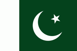
| Flag of Pakistan | |
Pakistan is the site of several ancient cultures, including the 8,500-year-old Neolithic site of Mehrgarh in Balochistan, the Indus Valley civilisation of the Bronze Age, the most extensive of the civilisations of the Afro-Eurasia, and the ancient Gandhara civilization. The region that comprises the modern state of Pakistan was the realm of multiple empires and dynasties, including the Achaemenid; briefly that of Alexander the Great; the Seleucid, the Maurya, the Kushan, the Gupta; the Umayyad Caliphate in its southern regions, the Hindu Shahis, the Ghaznavids, the Delhi Sultanate, the Mughals, the Durranis, the Omani Empire, the Sikh Empire, British East India Company rule, and most recently, the British Indian Empire from 1858 to 1947.
Currency / Language
| ISO | Currency | Symbol | Significant figures |
|---|---|---|---|
| PKR | Pakistani rupee | ₨ | 2 |
| ISO | Language |
|---|---|
| EN | English language |
| PA | Panjabi language |
| PS | Pashto language |
| SD | Sindhi language |
| UR | Urdu |


